What I did on my summerMemorial Day Vacation

Disgusted with my out-of-shape state, lately I’ve been trying to spend time in the Big Room more often. I hate exercise-for-the-sake-of-exercise, but I do enjoy getting out and exploring, so muscle-powered travel around the Big Room is a convenient fitness-improving activity. As we have a spiffy wooden kayak I’ve named “The Ascospore“, and live near a decent-sized body of water that I’ve not sufficiently explored, getting out and doing some lake-spanking was a Moral Imperative.

(If you’re reading this entry via RSS, you probably don’t see the map and the associated photographs below, so please follow the link to view this post directly…)

Also, here’s a direct link to the KML file if you want to pull it into a full Google Earth session for browsing…

Only 9¼ miles, but that’s not too bad. The Memorial-Day motorboaters were making a lot of waves, which were kind of fun but made the paddling somewhat slower and more strenuous than it would otherwise have been.

Oh, yeah, and I discovered that digiKam not only has a set of geolocation functions, but even has a plugin that will generate a KML file out of the track and photos, which I used for this map – I just had to edit the descriptions and picture titles and such to add whatever else I wanted. Very nice. On the other hand now I’m reminded that I need a better digital camera…

Of course, nerd that I am, I spent a good portion of the trip looking at the greenish water and cursing once again my lack of a decent microscope. There must be a huge variety of tiny little things in there. It also occurs to me that I know very little about diatoms, for example. But now my mind is obviously wandering due to sleep deprivation and it’s time for bed. Hopefully the embedded map works right. Let me know if not.

Geotagging through Asterisk?

Between telemarketers annoying me into getting my upgrade to Asterisk 1.6 finished and the hasty long-overdue road-trip back to and from Idaho again, I’m reminded of an idea that has been fluttering around in the back of my head, not unlike a small bat in the top of a bell tower.

My vast hordes of cult-like fans always seem to want to know where I am. This is obviously an issue in a case where I’m going to be driving 1600 miles, then turning around and driving back, over the span of 4-6 days. It would be pretty easy to set up something on a web page somewhere with some kind of map. The real problem is – how do I update the map?

In some places, I could stop for a while, haul out Igor, boot up, find a public wireless network connection to the internet, and do the update that way. However, that’s time-consuming and awkward, and I want to get this trip successfully completed as quickly as I can. Plus, it’s not always easy to find public network access points, especially through the barren, windy, snowdrift-covered wastelands of Southern Wyoming where a chunk of my route will take me. I have a hypothetical solution, however…

Continue reading Geotagging through Asterisk?

The “Stir-Fried Random” podcast, et al

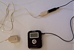
Almost time for the first real episode of “Stir-Fried Random”. It’s still a bit short (about 10 minutes or so is what it looks like I’ll have) but the sound quality is a bit improved. It’s not all frivolous, either – there’s high culture (Opera) and science (the first of my Microbiology Microlectures) in it.
I was also plotting to intermittently post what I’m thinking of as “Book-And-Record” audio files, each associated with a single picture (embedded as “album art” as well as likely in the blog post presenting it) saying something about subject of the picture…

Continue reading The “Stir-Fried Random” podcast, et al

Was it a mistake to buy Magellan GPS? Stay tuned…

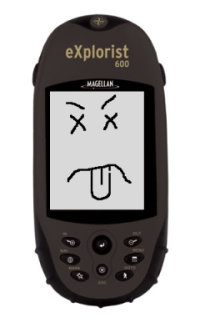
A dead Magellan eXplorist 600 GPS unitWell, the good news is that after calling their support line and trying the three-button-reset ritual that I hadn’t known about, my Magellan eXplorist 600 is still completely dead. They did not give me any hassle about replacing the unit, they just gave me an RMA number. My dead eXplorist was sent to their “Repair” center in Fort Worth, TX this afternoon. A replacement should arrive in about a week to a week-and-a-half.

The bad news is that Magellan has discontinued the $350 eXplorist 600 (and the rest of the eXplorist line) and insists that they can only offer their newer $250 Triton 500 as a replacement. I’ll withhold judgement on whether to be ticked off at the $100 of retail value that is being lost here until I see the specifications. It looks at first glance that the basic capabilities really are pretty much the same, so it may turn out okay…except for the most important feature by far, which I originally chose the eXplorist for in the first place: documented data formats.

The Triton series GPS’s appear to use a bizarre, undocumented file format, completely different from the documented format of the Meridian and eXplorist models. This means that as of right now, a Magellan Triton owner is not permitted to work with their OWN DATA without going through a proprietary, Microsoft-Windows-only GUI package, which ironically apparently uses GPSBabel to do file conversion. GPSBabel doesn’t support the Triton formats since there is no information available on how to read and write them yet. Since I have no Microsoft Windows machines anywhere, this means the shiny new Triton 500 (which I – seriously – can’t stop thinking of now as the “Magellan Vista”) will be nothing more than a highway map that requires batteries unless their proprietary “VantagePoint” software will run under WINE.

I’m hoping that they’ve merely been busy and will soon get around to adding this units specifications to their “Interface Solutions” information. This is where the openly-published file format (and communication protocol) specifications which were highly (and rightfully) praised by the GPSBabel project are made available for the now-abandoned Meridian and eXplorist units. If the GPS data I work so hard to obtain remains locked inside the proprietary format, only accessible at the whims of Magellan and Microsoft, I’m going to be extremely peeved. If, on the other hand, GPSBabel soon gets the information necessary to add support for the Magellan Triton line, the only serious complaint I have with all this will go away. Honestly, if I can at least get enough documentation to write my own simple waypoint, track, and route reader for their Triton files I’ll be happy.

I think a real, old-fashioned letter, printed on dead tree and everything, mailed to their corporate HQ is called for…

Anybody out there have any experience dealing with Magellan corporation? I’d like to think they want to do the right thing…

Another cheatin’ “Open Thread” and random stuff

No single topics to dominate a post today. I’m in a hurry (as usual lately) and have very little time. Tomorrow morning I’m back on the 1600-mile route back to Southeast Texas, hopefully to sign the closing paperwork on the house we’re trying to buy.

My Mountain Dew® Wine appears to be still sitting there after several hours. Either the benzoic acid is still inhibiting the fermentation (in which case it’ll go REALLY slowly) or the yeast is just in shock or something. We’ll see how it looks in the morning. I’ll leave it for a week or so anyway to see how it does. Meanwhile I’ll refrigerate the other batch of yeast culture until I get back. If I have to develop my own strain of “Mountain Dew Yeast” I will, dagnabbit!

I did get a chance to go for a quick walk in the Big Room on the way back from some errands yesterday, so it gives me an excuse to play with the wordpress map plugin again (RSS feed readers: the map doesn’t get inserted there. Please check out the interactive map at the blog’s website here.) Comments on the map (or anything else, really – I DID say “Open Thread” after all) are encouraged – what do you think? I’d like to do some audio content for points on a map at some point, too. Maybe some video.

Lava Rock Walk [height=560;width=560]

If anyone’s bored enough to want to see how I get from Southeast Idaho to Southeast Texas, I can post a map of that tomorrow, too…

New toy: “Twitter”

Wow – Celestron takes 8 business days to get me a terse one-sentence answer. BigC responds in one. Impressive. Apparently their technical people are all at trade-shows at the moment so my bigger question will have to wait until they get back, but they were at least able to answer my question about their “tabletop” digital microscopes magnification (answer: the “600x” really is optical magnification, not digital.)

Another digital microscopy WANT/DO NOT WANT post to follow when I get the followup reply. Meanwhile, after hearing about it on the This Week in Tech podcast for a while, I finally talked myself into signing up to play with the coincidentally named Twitter system.

Twitter logoIt sounds like a really stupid idea – “Oh, goodie, now I can broadcast ‘text messages’ no more than 140 characters long about trivial events in my life to the whole world! Whoopee!” “Wow! I can find out when random strangers are drinking coffee AS IT HAPPENS!” Thrills! Excitement! Adventure!…

On the other hand, having the messaging system watch for particular words might be a handy way of monitoring current events. Plus, there seems to be a lot of potential for fun, off-the-wall uses, even if many of them are kind of silly.

It DOES seem like kind of an ideal context to play with that “geostrings” concept I’ve been toying with. A terse, easily-machine-parsed format for geotag data that can fit into a “twitter” post and still leave room for a sentence or two to go with the geographic information seems like it might be useful. If you’re so incredibly bored that you want to see some examples, you can check out my own Twitter posts, several of which I’ve embedded geostrings into.